|
| ||||||||||
|
|


|
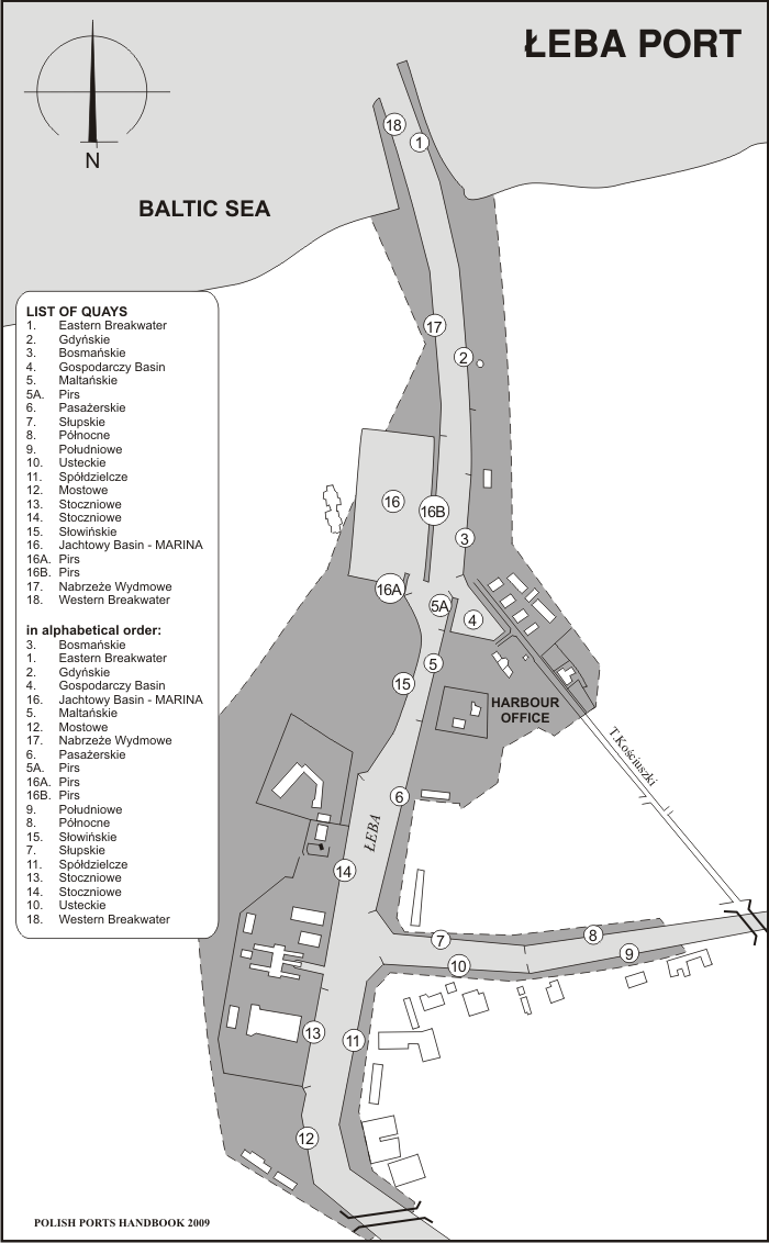
Introduction to Łeba The town is located at the mouth of Łeba river rising in Łebsko lake. Łeba is the health resort and popular seaside town. Now it has population of 3,857. The first historical mention of Łeba can be found in papal edict dated 1440. The pope Innocent II stated the mouth of Łeba River as East border of new episcopate in Wolin island. The population of Łeba was engaged in trade, handicraft and fishing on Łeba lake. From XV century Łeba belongs to Hanza union. The membership influences the growth of seaport in Łeba. Łeba has cooperated in seatrade with Gdańsk, Lubeka and Visby in Gotland. However the mouth of Łeba river was too small for sea ship, they were discharging on roads. In XVI century the town was destroyed by strong storms. The population has moved to region located far in the east and until now it's location of the city. In 1791 Łeba had a population of 500 and 97 houses. The inhabitants have earned fishing and discharging of salt and wood. In XIX century sea trade decreased due to development of railway and road connections and a competition of neighbouring ports. In order to enable discharging and loading inside the port there were carried out hydraulic works. It ameliorates regulation of river mouth. There were built new piers and riversides. Before II World War the port of Łeba has become one of the largest fishing port. Unfortunately the war made impossible to build new ocean fishing base. Port facilities The port is located in mouthpart of Łeba river. Port of Łeba is first of all fishing port. Bridges limit Port waters: first in mouth of Łeba river in distance of 1300 m from breakwater, second in Chełst Canal (Młynówka) - connects the outlet of Łeba river and Sarbsko lake.
Charges REMARK All rates quoted in this chapter are subject to change over a year. The prices are given for evaluation purpose. Charges are given according to the Decree of Minister of Infrastructure concerning the rates of harbour dues, valid from April 29th, 2004, (Journal of Laws of Republic of Poland 2004 no. 103, item 1082). |
||||||||||||||||||||||||||||||||||||||||||
|
||||||||||||||||||||||||||||||||||||||||||
| Shipyard DirectoryNivelco Polandimport - exportcompanies by city: BRZEG | ||||||||||||||||||||||||||||||||||||||||||